
Springfield Neighbors by Parcel
Public records describe a Springfield block in layers. County and city mapping show the shape and location of nearby parcels. The county property route then identifies the account or owner information for one selected tax lot. Recorded documents can add a dated transaction trail, while permit or code records can describe a property action. None of these sources is an occupant roster. The most useful result is often a map tax lot and a clear record date, because those can be carried to the next official system without guessing from a name.
| Source | What It Shows About a Block | Access |
|---|---|---|
| County or city GIS | Parcel boundaries, layers, and nearby tax lots | Visual geography, not an occupant roster. |
| Property or assessment route | Owner or account linkage for a selected parcel | One tax lot at a time; situs and mailing details differ. |
| RLID recordings | Recorded parties and transactions tied to a parcel | Ownership and document history, not a household list. |
| Permit or code records | Construction, land-use, or official action chronology | Do not infer the identity of every neighbor. |
| Voter information | Only elements lawfully released through the formal process | No public browse-by-street household directory. |
The property record is best read as a parcel record. An owner of record may receive mail elsewhere, and a mailing address can belong to a trustee, management entity, or post-office box. It does not prove that the owner occupies the Springfield parcel or that other people on the lot are named in the record.
Map a Springfield Neighbors Block
The adjacent-parcel method begins with one address, not a person’s name. Locate the reference property in the Lane GIS or City of Springfield interactive map, then zoom or pan only far enough to identify parcels that directly adjoin it. Write down each map tax lot before moving to a property record. The County Property Permits Search also permits a map click, which is useful when an address format does not return the expected parcel. The inspected tool did not show a buffer, radius, or formal neighbors control, so none should be assumed.
Address → GIS parcel → adjoining tax lots → property record → recorded documents. This sequence preserves the geographic link at every step and avoids treating a mapped label as legal title.
- Enter the complete reference address in a Lane or City mapping tool, or select its parcel on the map.
- Record the selected tax lot, then pan to parcels that directly share its boundary.
- Run each chosen lot through the public assessment or property route and keep its account details separate.
- Check a recorded document only when a party, date, or legal description is needed for the question.
- Compare the legal description and record date before joining results from different lots.
The full named-street record trail belongs with the Springfield Street Directory. A block review remains narrower: it follows immediately adjoining parcels rather than treating an entire street as one record set.
Springfield Neighbors GIS Tools
Lane County’s Map Gallery and Regional Land Information Database, commonly called RLID, add layers that make a parcel easier to place. The county describes its mapping tools as routes to property, tax, sales, planning, zoning, wetlands, floodplain, and related geographic information. The City of Springfield also publishes an interactive map and public ArcGIS layers for municipal geography. A map can orient the work, but a map label must be checked against the property or recording record before drawing a conclusion about an owner.
The RLID property research entry is one official starting point for moving from a Springfield parcel to regional property and recording information.
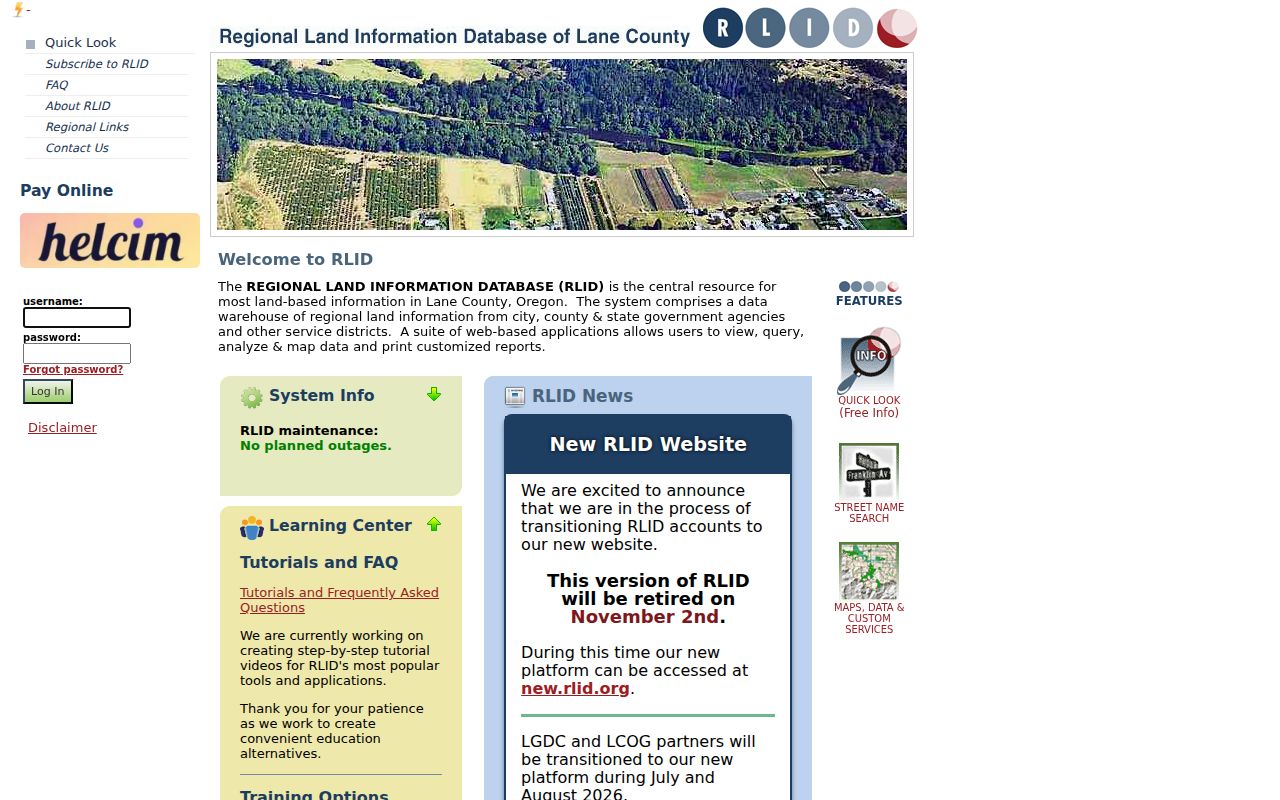
Use the displayed parcel, maplot, and record context to direct a later search. RLID documents relate to land and recorded actions; they do not compile the people currently present on a block.
Note: Keep a parcel’s tax lot and legal description with every map result, especially when neighboring blocks use similar street names.
Springfield Neighbors Permit Records
Permit material is a separate property layer. Lane County’s Property Permits Search accepts an address, map tax-lot number, permit number, or a map click. Once a property is selected, the application can be filtered by permit group, date, and status. The result can help establish a construction, planning, or code-compliance chronology for the specific parcel. It cannot establish continuous occupancy or identify every person connected with a nearby address.
The Lane County Property Permits Search provides the verified address and map-tax-lot routes.
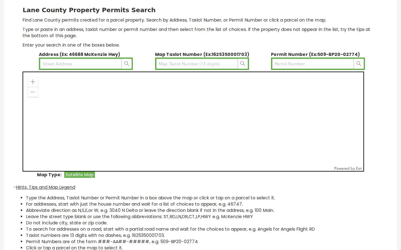
A clicked parcel can be carried to the permit results, then compared with its property account and recorded documents. Read every field in the context of the actual permit, not as a description of the surrounding block.
For recorded-document history, the Lane County Clerk’s computer index begins in 1972 and its images in 1994. Earlier routes include grantor-grantee microfilm for 1902–1970, transition microfiche, and deed books back to 1854 at the Deeds and Records Research Library. A recorded party establishes a dated document connection, not present residence.
Springfield Neighbors in Washburne
Washburne is useful as historical and civic context, not as a source for a current neighborhood roster. A 2017 Springfield planning report identified the Washburne Neighborhood Association, and the city walking-tour guide uses the Washburne Historic District Neighborhood Association name. The documented district occupies the old Springfield core, roughly between 2nd and 10th Streets and B and H Streets, with development from the 1890s through the 1940s. The planning record does not establish current activity, a contact point, or membership.
Washburne Neighborhood Association
Official record: identified in a 2017 city planning report.
Historic context: the walking-tour guide describes the historic district and its working-class development.
Directory status: no published member directory, current city umbrella directory, or verified current association contact was found.
That distinction protects the value of the record. A historic-neighborhood name can help a researcher find dated photographs, vertical files, Planning material, or a museum source for a particular property. It cannot be used to infer participation by a resident or to create a list of people associated with the area.
Springfield Neighbors Voter Limits
Oregon My Vote is a person’s own registration confirmation and update channel, requiring a name and date of birth. It is not a street browser. Formal voter-list requests are governed by ORS 247.945 and related provisions, and Lane County’s request form requires requester information, certification, scope selections, and a delivery method. Protected addresses and excluded identifiers remain unavailable even when a request is otherwise allowed. A record of participation can show whether a ballot was returned or credited for an election, never the choices made on it.
The Oregon Department of Justice Address Confidentiality Program and voter-address exemptions are meaningful limits. ACP participants, qualifying safety-exemption voters, certain officials, election workers, and other protected categories cannot be treated as gaps to fill. If a voter has a safety concern, the Secretary of State directs the person to the county elections official and SEL 550 process.
Note: A voter record can show permitted administrative facts, but it cannot reveal the choices made on a ballot.
Springfield Neighbors and Boundaries
Municipal boundaries, mailing labels, ZIP Codes, tax lots, and legal descriptions are separate systems. That matters near Glenwood, where City Council approved a 21.1-acre annexation in April 2025. A current Springfield label on a map or mail record should not be projected backward onto an older planning, parcel, or deed record. Preserve the date and the jurisdiction shown by the original source.
Postal delivery adds a second boundary check. The standard 97477 and 97478 Springfield delivery areas extend beyond the incorporated city, so a mailing label does not settle a parcel’s municipal status. Pair the complete address with City or County GIS and the dated record when a boundary question affects the result.
The same caution applies to the historic core. Springfield was platted in 1856, and older documents may use a subdivision, block, and lot rather than a current street number. In Washburne, a legal description and plat can explain a parcel connection that an address-only search misses. A simple location check can therefore be more useful than trying to expand a neighbors search beyond the record’s actual geography.
Springfield Neighbors Privacy Limits
Official parcel records are dated and attributable to a custodian. Unnamed commercial neighbor-listing tools can combine material from changing sources without showing the original record date or matching method. The official route is slower but makes the source, parcel, and document easier to test. Where a government record is wrong, seek correction or redaction from the public custodian. Oregon Consumer Privacy Act rights, ORS 646A.570–646A.589, concern covered businesses’ personal data and use a different correction or deletion process.
| Official parcel and record route | Unattributed commercial listing category |
|---|---|
| Shows a named custodian, selected lot, document type, and date. | May combine sources without a clear original document or refresh date. |
| Can be checked through the clerk, assessor, map, or record request. | May require separate privacy requests for data that is not a public record. |
Lawful use. Use Springfield block records for lawful property, family-history, or civic research. Do not use any record to stalk, threaten, harass, or harm a person.
Private group membership, delivery accounts, utility records, protected voter information, and current household composition are not made public by a parcel map. A missing or withheld result is a privacy boundary, not an invitation to reconstruct it.