
Springfield ZIP Code Delivery Coverage
USPS identifies two standard Springfield delivery ZIP Codes: 97477 and 97478. They serve Springfield delivery addresses but also reach adjacent Springfield mailing-area addresses, so neither code alone proves that a place is inside incorporated Springfield. USPS also assigns 97475 to an operational facility address in Springfield. It is not a third general delivery ZIP for the city. The most reliable current Springfield check is the full-address result from USPS ZIP Code Lookup, followed by a Springfield city or county geographic check when the city boundary matters. The post-office entries below identify delivery roles, not neighborhood boundaries.
| ZIP | Areas Covered | Post Office | Notes |
|---|---|---|---|
| 97477 | Standard Springfield delivery, including core Springfield and adjacent mailing-area addresses. | Springfield Post Office, 760 A Street, Springfield, OR 97477-4767 | Use a full Springfield address and USPS, then GIS, to distinguish delivery from city status. |
| 97478 | Standard Springfield delivery, including east and northeast Springfield areas and a wider mailing area. | Springfield Delivery Collection Unit, 4949 Main Street, Springfield, OR 97478-6073 | Springfield postal coverage can extend beyond the incorporated boundary. |
| 97475 | Postal operational or facility address, not a general Springfield delivery area. | Eugene Sorting and Delivery Center, 3148 Gateway Street, Springfield, OR 97475-9912 | Verify an exact Springfield address if encountered; do not use as a general Springfield filter. |
A ZIP Code is designed for Springfield mail delivery. Its service role is different from the way the City, Lane County, a tax account, or a historic Springfield deed describes a place. Keep the complete Springfield address with the result.
Verify Springfield ZIP Codes by Address
Start every Springfield ZIP code check in USPS with the full street address, city, and state. Save the five-digit result, then open a Springfield City or County geographic tool to determine whether the property lies within incorporated Springfield, an urban growth boundary, or unincorporated Lane County. The City of Springfield interactive map and the regional address data help with Springfield geographic context, but neither replaces the USPS delivery result. Once the Springfield place is identified, carry the complete situs address or map/tax-lot identifier into the property tools. A ZIP-only search cannot safely join a person, parcel, and jurisdiction.
- Enter the complete address in USPS ZIP Code Lookup and retain the five-digit result.
- Check City or County mapping for incorporated-city, urban-growth-boundary, and county geography.
- Find the parcel's account or map/tax lot using the complete situs address.
- Use the address or tax lot in the relevant record tool, preserving the record date.
- For an older source, compare the address with the legal description or historic plat.
Note: A current USPS result validates delivery geography, not a historic jurisdiction, tax-lot identity, ownership claim, or household list.
Springfield ZIP Code Search Limits
No local records portal with a verified Springfield ZIP-wide resident filter was found in this research pass. That is a useful Springfield ZIP code directory limit, not a reason to substitute a ZIP for an address. Lane County's Property Permits Search is a parcel and permit tool. Its inspected interface accepts an address, a map-tax-lot number, a permit number, or a parcel click, but it has no ZIP field. A permit record concerns work or an application tied to property. It is not a list of everyone who has lived there. Begin with a verified Springfield address and choose the matching route.
| Field | Search method | ZIP limitation |
|---|---|---|
| Address | Autocomplete text, then select the matching address. | Use after USPS identifies the complete address; no ZIP filter is shown. |
| Map Taxlot Number | Autocomplete text using the property identifier. | A tax lot is a parcel key, not a ZIP Code. |
| Permit Number | Autocomplete text for a known permit. | It does not group records by postal code. |
| Map parcel | Click a parcel on the map instead of typing. | Map selection still requires a particular property. |
The same Springfield address-first rule applies to Lane County Property Account Information. It supports owner name, account, map/tax-lot, and address routes, rather than an inspected ZIP route. Its owner field is an owner-of-record lead, not proof of Springfield occupancy.
Springfield ZIP Code to Tax Lot
Move from a Springfield ZIP Code to tax lot through the complete Springfield address. Lane's property account result can display the county account, map tax lot, taxpayer, owner, and situs. Situs means the physical property location. It can differ from the correspondence address used for an account or recorded document. The map-tax-lot identifier has 13- or 16-character formats in the county tools, and it is a more durable Springfield record key than a postal label. Carry it to Easy Property Information Lookup, permit tools, or regional mapping as the question requires.
See the Lane County Property Account Information screen for the address, account, owner, and map-tax-lot choices that follow a verified ZIP result.
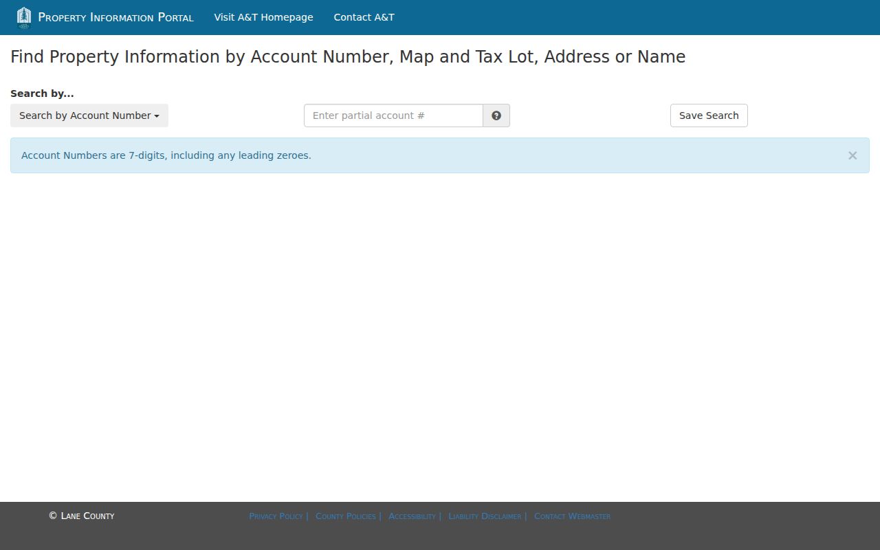
The account screen makes the needed shift clear: a ZIP identifies delivery geography, while a complete address or map tax lot locates one specific county parcel record.
- Situs address
- The physical property location, which can differ from the mailing address on a tax or recorded file.
- Map tax lot
- Lane County's parcel identifier, used by the public property and permit tools.
- Legal description
- The lot, block, subdivision, or township-based land description used to identify property in recorded material.
- Mailing address
- The correspondence location for an account or owner. It is not proof that the recipient occupies the situs.
For a full by-address record trail after a ZIP has been narrowed to one place, use the Springfield street directory route. It follows the parcel and recorded-document chain without treating a postal code as a resident list.
Springfield ZIP Code City Geography
The LCOG and Lane address layer gives the clearest local proof that a Springfield mailing label and incorporated Springfield are separate filters. In a documented 2026 Springfield address-point query, 16,419 points carried incorporated-city value SPR with 97477 and 12,965 carried SPR with 97478. The same query found 2,693 nonincorporated points using a Springfield and 97477 mailing label, and 3,741 using a Springfield and 97478 mailing label. One SPR point had 97475. These are Springfield address-point counts in a geographic data layer, not population totals, mail-delivery counts, or evidence that the code is a municipal boundary.
| ZIP Code | Incorporated SPR points | Nonincorporated Springfield-mailing points | What the count shows |
|---|---|---|---|
| 97477 | 16,419 | 2,693 | The same mailing ZIP appears both inside and outside incorporated Springfield. |
| 97478 | 12,965 | 3,741 | Postal geography and municipal geography overlap but do not match. |
| 97475 | 1 | Not reported as a general delivery area | A facility ZIP cannot be treated as a third citywide delivery designation. |
The address layer includes the concatenated address, mailing city_name, incorporated geocity, ZIP, urban-growth-boundary, and annexation-history fields. It is a strong geography cross-check, while USPS remains the delivery authority for a full address.
Springfield ZIP Code Boundary Mismatch
A Springfield ZIP code is not a city-limit line. A postal city label can remain Springfield for an unincorporated location, and a city property can be described through a different Springfield mapping or historic-geography system. The City Site Address layer and interactive map provide a five-digit ZIP field and Springfield municipal context, but both need to be read alongside USPS and the parcel record. For an official regional data description, RLID's information page explains its property-report and recording-history coverage. Map data helps identify place. It does not create a ZIP-wide name list.
Springfield ZIP Code Terms
Springfield postal terminology is easy to overread in older family papers and property files. The terms below keep the different Springfield systems separate. A five-digit ZIP is useful for a current delivery check, while a tax lot or legal description is usually the stronger key for Springfield deed and parcel work. The research did not document a general Springfield postal ZIP-wide records search. Use the labels to choose the next official tool, rather than assuming that one label translates into a list of people.
- ZIP Code
- The five-digit postal routing code returned for a complete delivery address.
- ZIP+4
- An added four-digit delivery detail used with the five-digit ZIP; it does not decide city jurisdiction.
- PO-box ZIP
- A postal code used for post-office box service, which may not describe a general delivery area.
- Facility ZIP
- A code assigned to an operational postal facility, such as Springfield's 97475 address, rather than a general resident delivery area.
- Carrier route
- A delivery-route grouping used by the postal system. It is not a city boundary or parcel identifier.
Note: The date of the document matters because an old mailing label may reflect a prior route, rural convention, annexation, or address format.
Springfield ZIP Code Date Changes
Springfield records geography has a date as well as a boundary. City material says Glenwood has been under Springfield jurisdiction since 1999 after earlier Eugene planning history, and the Springfield City Council approved a 21.1-acre Glenwood annexation on April 8, 2025. That does not change the rule for a particular Springfield address: match the record date to the city, county, parcel, and mailing context that applied then. A Springfield riverfront location can require a postal check, a boundary check, and a historic jurisdiction check before a record is connected to a present Springfield description.
The City Council's Glenwood annexation roundup documents the April 2025 action. For older Springfield work, original plat or legal-description language may be more reliable than a current ZIP Code.
Springfield ZIP Code Research Limits
A Springfield ZIP Code can narrow a location but cannot establish a current household, ownership, city jurisdiction, or older Springfield address chain by itself. A Springfield ZIP code directory starts with USPS delivery validation for a complete address. Springfield City and County mapping distinguish municipal and parcel geography. Assessment, permit, and recorded-document tools require an address, tax lot, account, legal description, or document detail. Retain the source date and the exact key used at each step. That approach is both more accurate for Springfield and less likely to turn a mailing label into a claim the underlying records do not support.